A Contested County
See below to learn about the 1864 Shenandoah Campaign. A downloadable booklet is available here.
The Valley of Sorrows
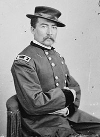
By August 1864, newly appointed U.S. Commanding General Ulysses S. Grant had formed a new army to deal with the ever problematic Confederate presence in the Valley of Virginia, often referred to as the Valley of Sorrows by the Federal command. Grant could not afford to fare as his predecessors had. With the Presidential election looming and Abraham Lincoln’s re-election in doubt, Grant placed his trusted cavalry commander; Major General Philip H. Sheridan in charge of the new Army of the Shenandoah on August 2 and by August 7, Sheridan had assumed command in Harpers Ferry.
Jefferson County, West Virginia had, since 1859, been a focal point of the Civil War in Virginia and modern day West Virginia. Never more dramatically would this be exhibited than in August 1864, when two armies, amassing in size and strength, embarked on one of the most devastating campaigns of the War.
“We scared Abe Lincoln like hell…”
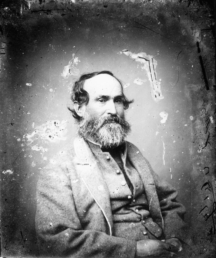
As directed by General Robert E. Lee, Lieutenant General Jubal A. Early had repeatedly probed Union territories to draw Union forces from Lee’s front near Petersburg in to order defend the Union Capital of Washington, D.C. Following a resounding victory at Lynchburg, Virginia, Early pushed into Maryland and Pennsylvania, where his subordinate, Brigadier General John McCausland, burned Chambersburg.
The summer of 1864 had been one of great success for Confederate Lieutenant General Jubal A. Early. After assuming command of the Army of the Valley, Early commanded a series of major victories at Monocacy, Cool Spring and Kernstown, along with a daring raid which halted just outside of Washington, D.C. at Fort Stevens. By August 1864, Early felt very confident that any attempt by Union forces to check his movements in the area would be futile.
Tour starting point: Fillmore Street, Harpers Ferry, West Virginia
Start at the Lockwood House, located in Harpers Ferry National Historical Park
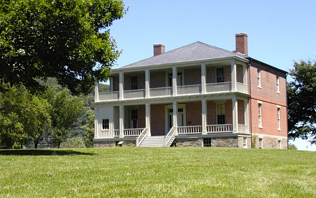
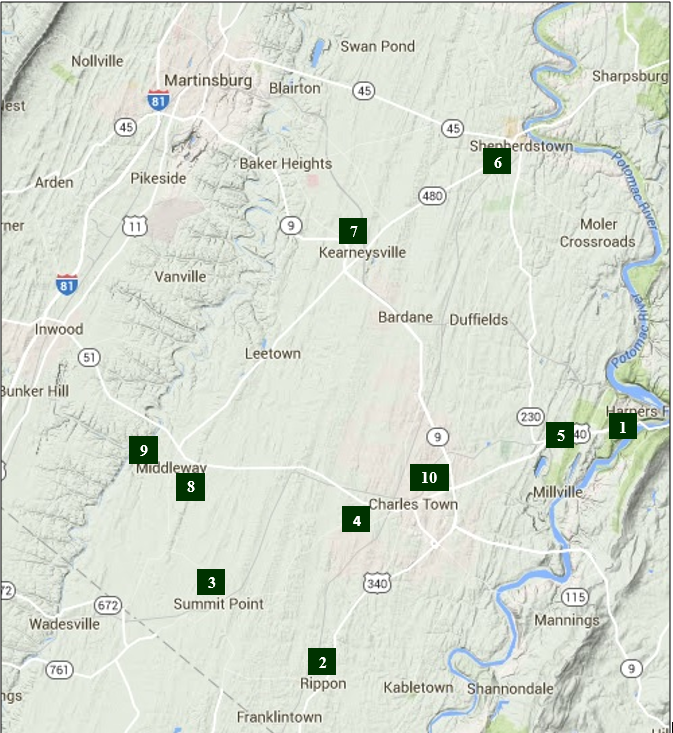
Stop 1 – Sheridan’s HQ
When Sheridan arrived here on August 7, 1864, he met immediately with his commanders to determine his objectives for the upcoming campaign. Sheridan quickly identified Winchester, Virginia as his objective, yet, with Jubal Early located near Bunker Hill, West Virginia, Sheridan also had to be careful of leaving his supply lines vulnerable. Though Sheridan would move his headquarters as the Army moved to various points in the County, Harpers Ferry remained his base of operation for the entirety of his time in Jefferson County.
Following the tour: From Harpers Ferry NHP, turn onto US 340 S, heading toward Charles Town. Go approximately 5 miles. Turn right onto US 340 S/ WV 9 ramp toward Berryville. Go approximately 7 miles to St. John’s Church in Rippon on your left.
Stop 2 – Ripon Store
Ripon Store, now just called Rippon, was a key crossroads on the Charles Town – Berryville Turnpike. Sheridan’s Cavalry moved through here on their way to a surprise engagement at Guard Hill, near modern Day Front Royal, about a week after taking command of the Army. This little village played a role in several campaigns and engagements. It was on August 21, 1864 during the opening stages of the Battle of Summit Point, that Confederate General Fitzhugh Lee pushed Federal cavalry under Charles Lowell back to Charlestown through Ripon Store. The historic “Ripon Lodge Farm” on your right was present at the time of this fighting.
Following the tour: From St. John’s church, turn left onto US 340 S. Go 20 yards to Withers Larue Road. Turning right, go approximately 3 miles to Leetown Road. Turn right onto Leetown Road. Go 1.5 miles to Thomson Street. Go 0.4 miles to Summit Point Road. Turn left onto Summit Point Road, turn right into the Railside Market.
The Confederate Advance
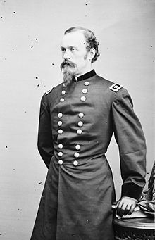
While Fitzhugh Lee followed the Federals back toward Charles Town, Confederate General Joseph Kershaw led infantry and cavalry from Winchester, attacking General James Wilson’s (pictured right) cavalry here, at Summit Point in the first stages of the Battle of Summit Point. A pitched fight took place here for hours with the Federal troopers ultimately retiring to their lines outside of Charles Town. Confederate General Richard Anderson, rather than joining the continued assault, opted to go into camp, a decision that altered the broader conflict, perhaps saving the area a bloody fight.
Following the tour: Head NE on Summit Point Road back toward Thomson Street. Go 3 miles to Earle Road, turning left. Follow Earle Road for 2.5 miles, to Middleway Pike, (WV 51) turning right. Go 3 miles turning into the Old Charlestown Train Depot on your right. Note: The route you are traveling on Earle Road is where the main Confederate assault took place at the Battle of Summit Point, August 21, 1864.
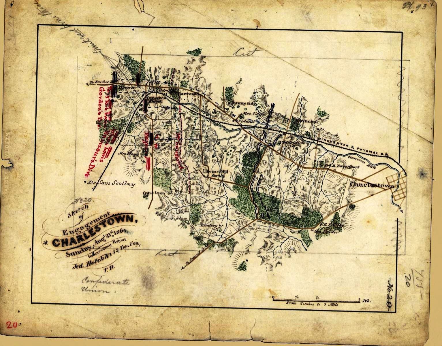
“Early is down upon us like mad!”
As the fighting was coming to an end at Summit Point on August 21, 1864, Confederate General Jubal A. Early felt as though his plan was coming to fruition. Rebel forces had pushed the Federal army back at two points and his large force of infantry had started deploy along Earle Road and Middleway Pike. They had successfully fought back Federal pickets along the ridgelines encompassing old Washington family estates such as Cedar Lawn, Richwood Hall, Sulgrave, Harewood and Locust Hill, and now waited for Anderson and Kershaw to arrive from Summit Point for a final large assault on Philip Sheridan’s entrenched forces located about two miles outside of Charles Town. Anderson and Kershaw never arrive, halting the attack and in doing so, ending the Battle of Summit Point. That night, Sheridan withdrew his forces through Charles Town to Halltown.
Following the tour: Turn right out of the Train Depot parking lot onto WV 51 headed toward Charles Town. WV-51 turns into W. Washington Street. Continue for 6 miles, turning right onto Millville Road. Pull into a small parking lot on your left.
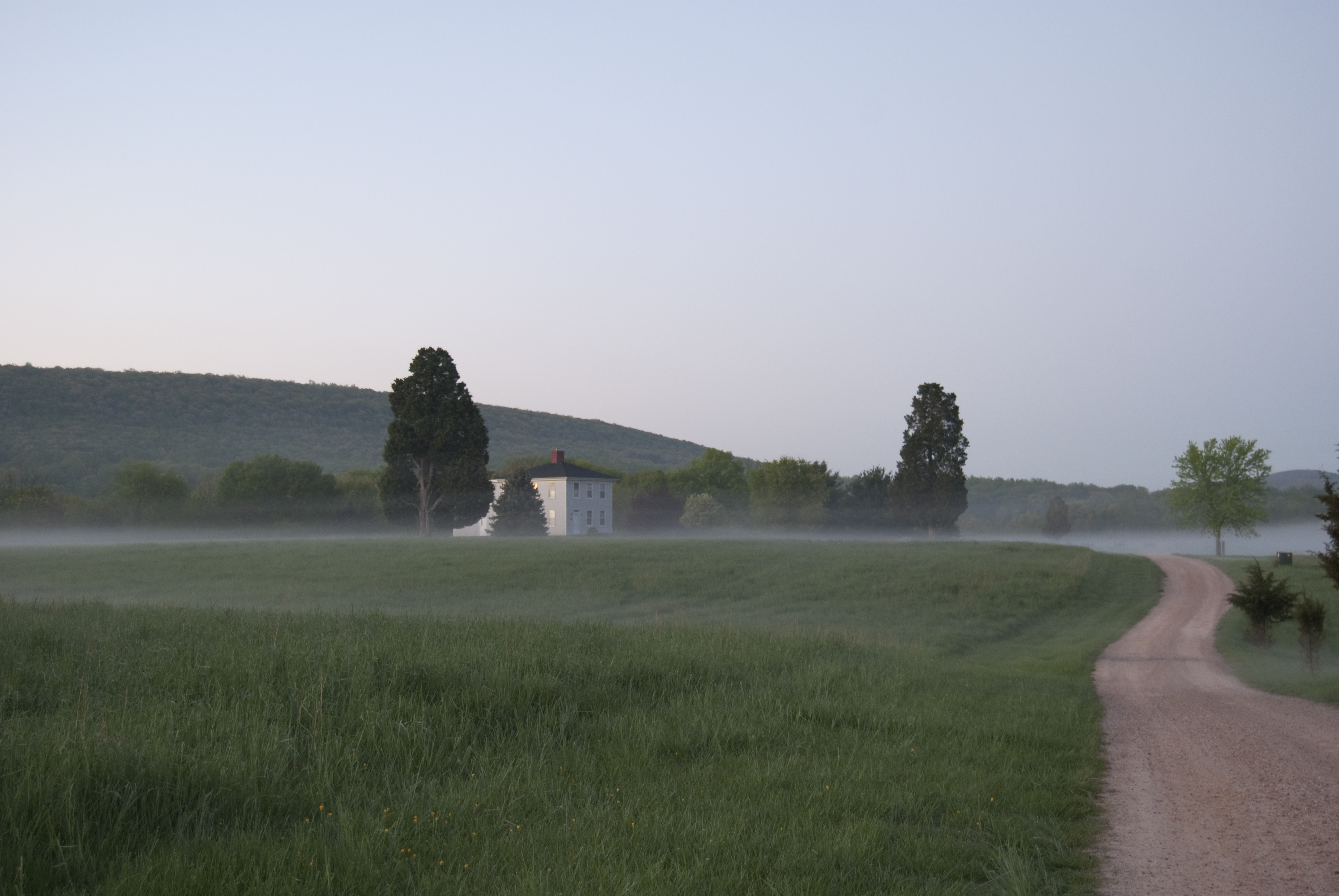
Probing the Line
From this position, near Halltown, Sheridan redeployed his lines in a much stronger position, with his line stretching from the Shenandoah River to the Potomac. Sheridan, now content with his defenses, probed Early’s position to determine what elements of the Confederate army were to his front. Several skirmishes take place in and around the fields where you stand today with limited casualties. Yet as Sheridan garnered intelligence, he began to formulate his plans, desperate to prevent another Confederate invasion into Union territory. To protect the valuable Pack Horse Ford near Shepherdstown, he dispatched cavalry under General Wesley Merritt to guard the ford.
Following the tour: Turn right out of the parking lot toward US 340 N. Turn left on to US 340 S. Go 1 mile until you reach WV-230 where you will turn right onto that road. Go roughly 7 miles to Gardners Lane where you will turn left. Go 1.3 miles and continue onto Morgan Grove Road for another 1.5 miles. Take a left on WV-480 and an immediate left at Starkey’s Landing. Arrive at Morgan’s Grove Park. Walk to the Pavilion near an old Spring House, which is all that remains of Fountain Rock, the home of Alexander Boteler, Confederate Congressman. The home was burned in 1864 by General David Hunter.
Operations in the Back Country
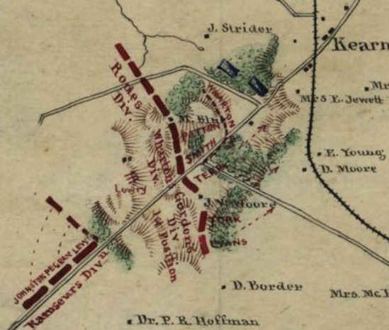
As Sheridan ordered his Cavalry north to Shepherdstown on August 25th, Early simultaneously orders infantry under the command of Joseph B. Kershaw to move toward Shepherdstown, screening the enemy cavalry. Four miles southwest from where you stand, a surprise encounter of the two forces began a heated engagement. Simultaneously, forces begin to mass at Kearneysville for an unexpected engagement. Merrit, with fellow General George A. Custer are able to drive back the Confederate advance, but now at Kearneysville, a larger rebel force has formed for battle. Chief Cavalry General Alfred Torbert deploys General James Wilson in support of Merrit and Custer for an assault on the Confederate infantry located at Kearneysville.
Following the tour: Leaving Morgan’s Grove Park on Starkey’s Landing, turn left on WV-480. Go 4.2 miles to Kearneysville, turning left into the parking lot just before the Rt. 9 bridge overpass. Looking Southeast, you are viewing the fields were Confederate defenses took position against advancing Federal Cavalry.
Engagement at Kearneysville
Roughly one mile to your south, three divisions of Confederate infantry have massed under the command of General John C. Breckenridge and General Gabriel C. Wharton. Their strength is not fully known by the advancing Federal cavalry under Torbert. The Federal cavalry has with it several artillery pieces which they begin to use to great effect. A sharp fight ensues with the Rebel line beginning to break. Yet with the arrival of reinforcements at the Confederate rear, the Union troopers quickly begin to be overwhelmed. After learning from captured Confederates of the strength of Confederate forces, Torbert orders Merritt and Wilson to withdraw back to the main body of the Union Army near Halltown.
Following the tour: Turn left out of the parking lot onto WV 480 (Leetown Road) and travel approximately 8 miles. Turn left onto CO RT. 1/7 and take a right onto East Street. There will be a parking lot on your right by a historic cemetery.
Engagement on the Opequon
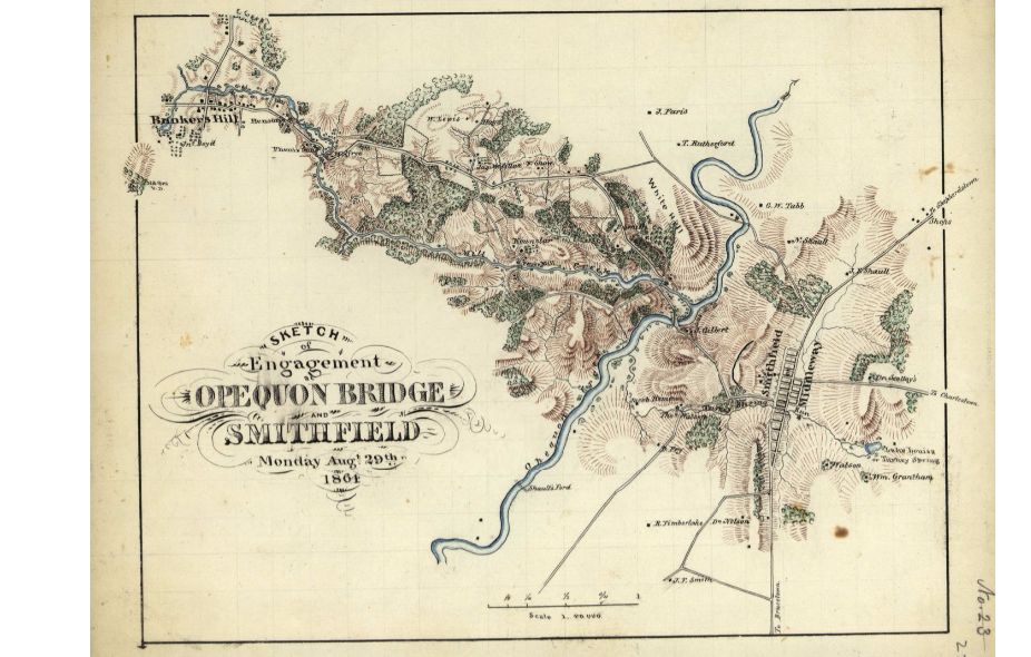
After the fighting of the 25th at Kearneysville and Shepherdstown, fighting resumed August 28, as Federal cavalry drove Confederate forces around Leetown back to Smithfield (now called Middleway), where a covered bridge offered one of the few all-weather crossings over the Opequon Creek. Facing an entire Federal cavalry division, the Confederate troops retreated across the Opequon, Where you stand, Cavalry divisions under General Wesley Merritt confronted Confederate General Lunsford Lomax’s cavalry and horse artillery, while General George A. Custer’s division flanked the Confederates sending them in retreat back across the Opequon Creek.
Following the tour: Turn left out of the parking lot onto East Street. Turn right onto Grace Street, go approximately ½ mile. Turn right onto CO Rt. 1/9 and go approximately ½ mile until you reach the ruins of the Opequon Stone Bridge.
 The Battle Resumes
On the morning of the 29th, Custer’s First Brigade was sent on a reconnaissance toward Bunker Hill to locate the Confederates. As he headed toward Bunker Hill, Custer encountered General Stephen Ramseur’s and General John Gordon’s infantry divisions. These divisions immediately moved against Custer, with orders from Early to chase the Federals across the Opequon. At about 11:30 a.m. the Confederates began an artillery bombardment from batteries on the heights across the Opequon. The attack developed with Ramseur’s Division crossing the creek around the bridge and directly west of Smithfield, where you stand. As Ramseur’s leftmost brigade began to swing around Merritt’s right flank, Merritt realized he was in danger of being trapped and began a withdrawal to the east. The Federals withdrew toward Charles Town. The Confederates, having accomplished their aim to drive the Federal forces from the Opequon Crossing, Confederates halt their attack and retire to Bunker Hill.
Following the tour: Return south on CO Rt. 1/9 toward Grace Street. Turn left on Leetown Rd./Queen Street. Turn right at the 1st cross street onto Co Rte 1/7. Merge onto WV-51 and go 6.5 miles. The Carriage House Inn will be on your right in Charles Town. Street parking is available.
Planning a New Strategy
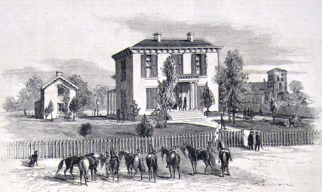
Following the actions in August in Jefferson County, General Philip Sheridan opts to move his army deeper into Virginia. With Winchester, Virginia being his main objective, Sheridan begins to move parallel to the Confederate Army, which by now is spread from Winchester to Martinsburg. On September 3-4, 1864, Sheridan will again attack the Confederates at Berryville, Virginia. With a much larger force, he is able to push them back to their defenses in Winchester. On September 16, Commanding General of the United States Army, Ulysses S. Grant meets Sheridan here at the Rutherford House. In a parlor of this fine home, now a Bed & Breakfast, Sheridan and Grant develop a new strategy for dealing with the Confederate presence in the Shenandoah Valley. It will become known as “The Burning.” Not only will Sheridan attack Jubal Early’s forces relentlessly, he will systematically destroy all of the farms and supply sources in the entire Valley. Grant informs Sheridan that the Valley should be laid bare so that “A crow must carry provisions to fly over.” With those orders, one of the most devastating campaigns to take place in military history begins.
This tour was produced in a partnership between the Jefferson County Historic Landmarks Commission, the Jefferson County Farmland Protection Board and the Jefferson County Visitors Convention Bureau. Sources for this tour were referenced from the American Battlefield Protection Program; author Scott Patchan’s The Last Battle of Winchester: Phil Sheridan, Jubal Early and the 1864 Shenandoah Campaign, Harpers Ferry National Historical Park, Mr. William Chappell and the Middleway Conservancy. You may have noticed that many of the areas where these historic events took place are now developed. Preservation efforts continue, but need private support. For more information on how you can help preserve these hallowed sites, visit: www.JeffersonCountyHLC.org
